Harold Place is a busy bus route and and is heavily used by people dropping off and picking up at the station, college and large medical centre. The plan to close the road has been heavily criticised by local residents.
Here local historian Steve Peak, who himself has described the plans as ‘bonkers’, looks at the long history of Harold Place.
He writes: “King Harold was murdered at the Battle of Hastings in 1066, and now the road named after him may suffer the same fate. But Harold Place in the town centre is not a minor road; it is the key access route from the seafront to Hastings Station. The grand-sounding Hastings Town Centre Public Realm and Green Connections Project, unveiled recently, wants to replace this busy highway with lots of pavements and a ‘Lost River Park’. But there is nothing in the £10 million plan about what will happen to the seafront traffic wanting to get to the station.
The ‘Lost River’ is presumably named after the Priory Stream, which is not lost, as it is underneath Harold Place. Until the late 1830s the stream was running down the Priory Valley through what is now the town centre, being the drain for the marshland where the Priory Meadow shopping centre is now and for the streams coming down off the surrounding hills.
Following the clearance of the America Ground in 1835, Hastings was rapidly expanding westwards towards the new town of St Leonards. But this development was seriously obstructed by the Priory Stream, and by the fact that there was only one bridge over it, in front of where the Nat West Bank is today.
So in 1838/39 the bridge was removed and a culvert (underground tunnel) was created for the stream, from where Station Road is now to the beach. The area on and around the culvert was surfaced and levelled, creating the open space that became the heart of the town when the Albert Memorial clock-tower was built near the site of the bridge in 1863.
Until 1930 Harold Place was level with the beach, so you could stand at the Memorial and see the sea. Luckily, borough engineer Sidney Little (King Concrete) knew that this made it increasingly likely that the town centre could be flooded, so he raised the height of the sea wall.
The unnecessary demolition of the Memorial in 1973 must be one of the worst disasters in the town’s modern history. Perhaps some of the £10 million could be spent on creating a memorial to the Memorial on its former site?
The history of Harold Place and the town centre is in my book The America Ground. If you want to comment on the project and the potential demise of Harold Place, go to consultation.eastsussex.gov.uk.
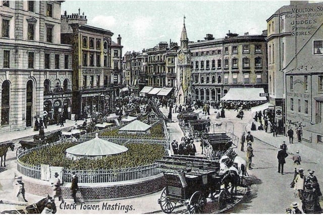
1. Harold Place
Harold Place and the underground toilets in the early 1900s Photo: supplied
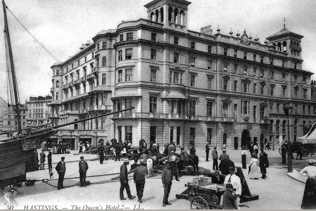
2. Harold Place
Harold Place and the Queens Hotel in the early 1900s Photo: supplied
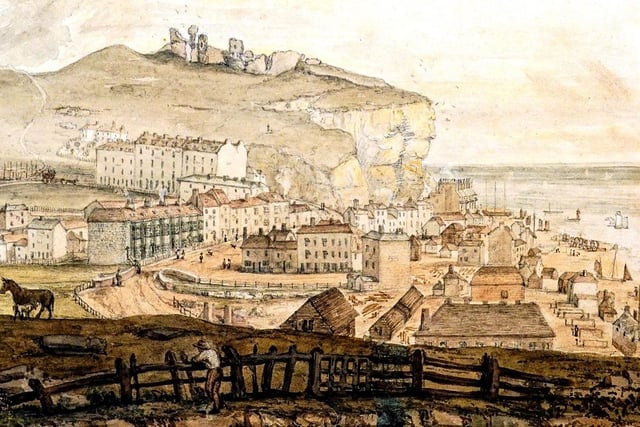
3. Harold Place
The Priory Stream and bridge in 1824 Photo: supplied